


Place Categories: Attractions, Hiking, and SightseeingPlace Tags: attractions and hiking
Water Wheel Falls Hiking Trail: A Hidden Gem of the East Verde River
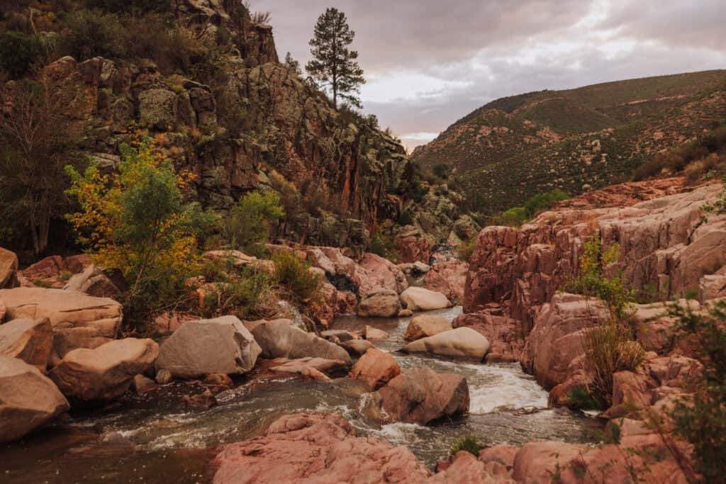
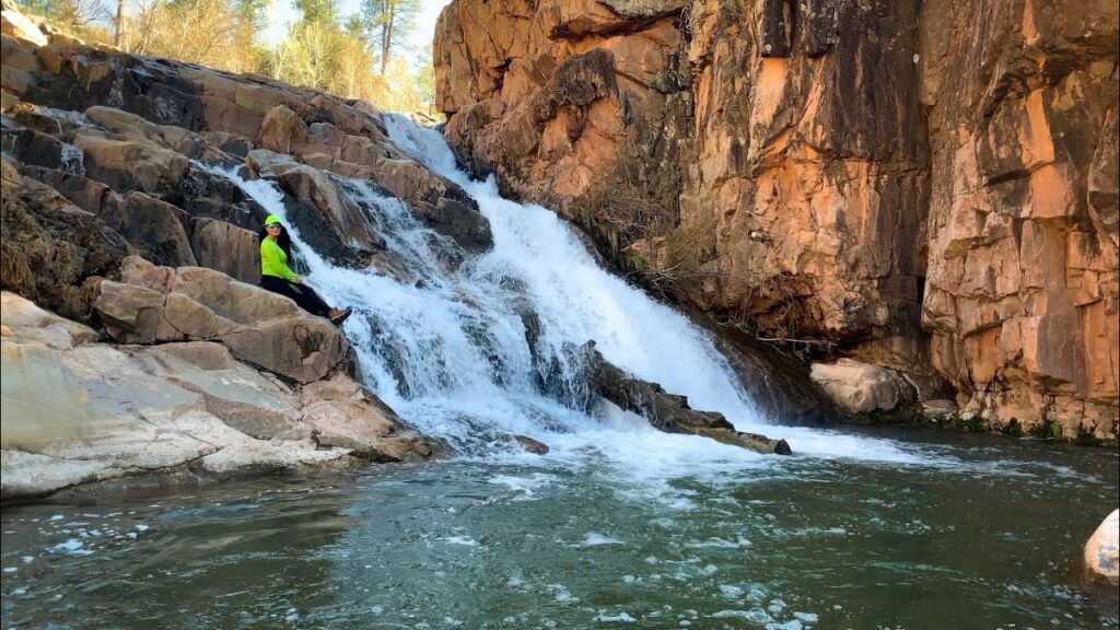
Discover one of the most rewarding short hikes in the Payson area. The Water Wheel Falls Hiking Trail is a scenic 1.6 to 1.8-mile round-trip journey that perfectly captures the beauty of Rim Country’s riparian landscapes. Following the banks of the East Verde River and Ellison Creek, this trail leads adventurers to stunning cascades and deep, emerald swimming holes that serve as a perfect escape from the Arizona heat.
Whether you are a photography enthusiast looking for the perfect waterfall shot or a family seeking a picturesque picnic spot, this trail offers a rich blend of natural beauty and historical intrigue.
A Step Back in Time: The Historic Water Wheel
The trail derives its name from a fascinating piece of local history: a preserved 1930s-era water wheel once used for gold mining operations. Many visitors unknowingly pass right by this relic; you can find it near the beginning of the trail, located just to the left of the restroom facilities. It serves as a quiet monument to the rugged mining heritage of the Tonto National Forest.
The Hiking Experience
While the distance is short, the trail is considered Moderate in difficulty because it requires navigating uneven, rocky terrain and scrambling over granite boulders. The path is lined with lush vegetation, providing a refreshing contrast to the surrounding high-desert landscape.
- The Cascades: The trail features several small drops and larger falls where the water has carved smooth chutes into the ancient rock.
- Swimming & Exploration: Multiple deep pools along the route offer excellent swimming opportunities, though water levels can fluctuate significantly with the seasons.
- Wildlife & Flora: Keep an eye out for local bird species and the unique flora that thrives along the riverbanks.
Trail Essentials & Logistics
- Distance: ~1.6 to 1.8 miles out-and-back.
- Elevation & Terrain: Generally level but involves rocky creek crossings and boulder hopping.
- Cost: A day-use fee (approximately $10) is required for parking from April through October. Please bring cash as payment is often handled at a self-service station at the trailhead.
- Amenities: There is a public restroom at the parking lot, but no potable water is available. Ensure you bring at least one liter of water per person.
- Pet Policy: Dogs are permitted but must be kept on a leash for their safety and the protection of local wildlife.
Getting There & Navigation
From the intersection of Highway 87 and Highway 260 in Payson, head north on Highway 260 for approximately 2 miles, then turn right onto Houston Mesa Road. Follow Houston Mesa Road for about 7.8 miles until you reach the signed parking area on the right-hand side.
Pro-Tip: The trail follows the river most of the way. While there are several “social trails” created by other hikers, staying close to the creek bed will ensure you reach the main falls without getting off track.
⚠️ Essential Safety & Etiquette
- Flash Flood Warning: This area is highly susceptible to sudden flash floods, even if it is not raining directly over the trail. Always check the local weather forecast and avoid the canyon if there is a chance of rain in the surrounding mountains.
- Footwear: Sturdy hiking boots or trail shoes with excellent grip are essential. The rocks near the water can be extremely slippery when wet or covered in fine silt.
- Leave No Trace: Help preserve this beautiful location by packing out all trash and leftovers. Keeping the East Verde River pristine is a responsibility shared by all visitors.
No Records Found
Sorry, no records were found. Please adjust your search criteria and try again.
Google Map Not Loaded
Sorry, unable to load Google Maps API.
-