
Place Categories: Attractions, Hiking, and Sightseeing
Abandoned Mineral Belt Railroad Tunnel: Arizona’s “Tunnel to Nowhere”
Tucked into the rugged face of the Mogollon Rim lies one of the state’s most fascinating historical failures. The Abandoned Mineral Belt Railroad Tunnel is all that remains of an ambitious 1880s project intended to connect the lumber-rich north of Arizona with the mineral-heavy mining towns of the south.
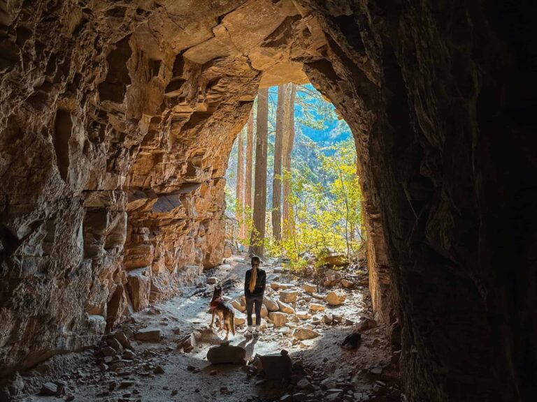
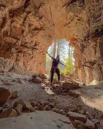
Today, hikers can explore this 70-foot-deep “folly,” walk inside the hand-blasted cavern, and stand where workers once dreamed of conquering the 2,000-foot escarpment that defines the Rim Country.
A Glimpse into History: Colonel Eddy’s Dream
In 1881, businessman James Ward Eddy (Colonel Eddy) envisioned a railroad that would traverse the “backbone of Arizona”. His plan required a massive 3,100-foot tunnel to be blasted through the solid rock of the Mogollon Rim. Work began in 1883 with a crew of over 40 men, but funding ran dry after they had excavated only a tiny fraction of the goal.
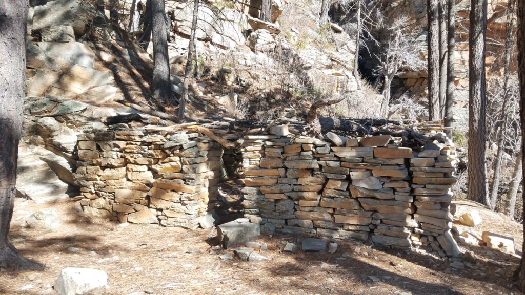
- The Powder House: Just outside the tunnel entrance, you can still see the ruins of the stone powder house where explosives were stored over 140 years ago.
- The Tunnel: Though it looks deep from the outside, the tunnel ends abruptly after about 70 to 100 feet, leaving a perfectly preserved workspace of the 19th-century miners.
Two Ways to Experience the Tunnel
Depending on your starting point, this adventure offers two very different experiences. Most visitors choose the route that fits their location—either at the base of the Rim or along the scenic Rim Road.
Option 1: The “Bottom-Up” (From Washington Park Trailhead)
This is the classic forest approach, starting in the lush valley and climbing toward the Rim.
- Trailhead: Washington Park Trailhead (near the end of Forest Service Road 32).
- Distance: ~4 miles round-trip.
- The Hike: Follow the Arizona Trail north. The path winds along the East Verde River before splitting off for a steep, final scramble up to the tunnel.
Option 2: The “Top-Down” (From Rim Road 300)
This route starts at the top of the Mogollon Rim, offering sweeping panoramic views before descending toward the tunnel.
- Trailhead: Located on FR 300, approximately 12 miles from the eastern entrance (near Highway 260).
- Distance: ~1.5 miles round-trip.
- The Hike: A short but very steep descent that requires careful footing on loose rock and scree.
Adventure Essentials
- Difficulty: Moderate to Strenuous. The final approach to the tunnel is notoriously steep and involves loose gravel.
- Elevation Gain: Roughly 800 to 1,000 feet depending on your route.
- Best Time to Visit: Late Spring through Fall. Be aware that Rim Road 300 often closes during winter months due to snow.
⚠️ Pro-Tips & Safety
- Watch Your Footing: The “scree” (loose rock) near the tunnel entrance is very slippery. Trekking poles are highly recommended for the descent.
- Pack for the Rim: Temperatures at the tunnel are often 10–15 degrees cooler than in Payson. Bring a light jacket and plenty of water.
- Download Your Maps: Cell service is non-existent at the trailhead. Be sure to have your offline maps ready before leaving.
- Leave No Trace: This historic site has unfortunately seen some graffiti. Help us preserve this piece of Arizona history by staying on the trail and packing out all trash.
The connecting trail that leads to the abandoned tunnel isn’t on most maps. To find it, use the Washington Park trailhead (34.430262, -111.260810) in Tonto National Forest and hike north for about 1.5 miles. A sign will then point you onto another trail that heads to the east. This trail slowly becomes harder to distinguish and eventually you’ll be relying on rock cairns that lead you up a very steep and rocky slope. The trail here is very difficult but you don’t have to go far before it levels out and the abandoned partial-tunnel will be directly in front of you.
No Records Found
Sorry, no records were found. Please adjust your search criteria and try again.
Google Map Not Loaded
Sorry, unable to load Google Maps API.
-